safEarth

Transnational advanced management of land use risk through landslide susceptibility maps design

01.06.2017
30.11.2019
974.695,50 EUR

4

About

SafEarth will tackle the issue of landslide hazards in the cross-border region. It is a well-known fact that climate change has impact on weather extremes and flooding, which consequently leads to soil instabilities. Many landslide zones are located in densely populated areas and directly endanger people and properties. The aim of safEarth is to identify and classify those areas. The partners will jointly handle risks of landslides through applied research, technology transfer, knowledge dissemination and rehabilitation measures. Project’s main outputs include producing Landslide susceptibility maps (LSM), which will provide information to local government and citizens in spatial planning, protection of human health, biodiversity and similar fields of work, and reconstructing a landslide-damaged site in Žepče.

Partners

The lead partner, Croatian Geological Survey (CRO), will manage, coordinate and guide partners in the implementation of best practices during the design of LSM. Results of these activities will be used to contribute to risk preventions in terms of land use, groundwater protection, human health and nature protection.

Geological Survey of Montenegro (MNE) will provide support in the field of geological and geochemical explorations. The partner will implement LIDAR and GIS technologies to make high-resolution maps for pilot areas in Montenegro.

Faculty of  Mining, Geology and Civil Engineering (BA) will cover field investigations for pilot areas in Bosnia and Herzegovina. The data will be compiled together with results of other partners in the general guidelines for LSM.

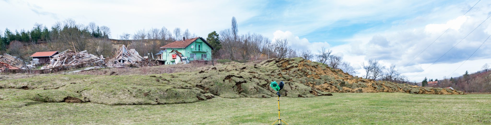
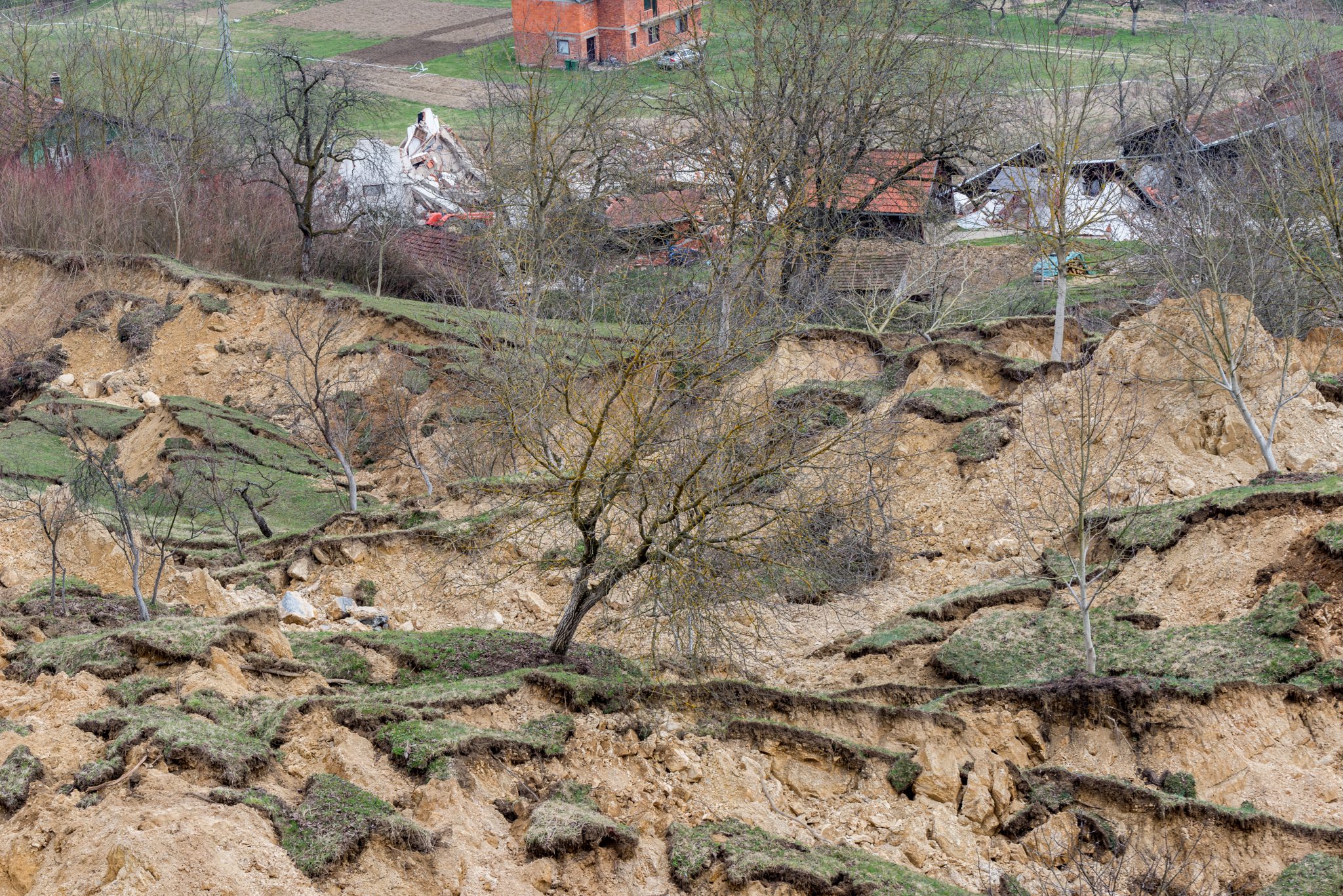
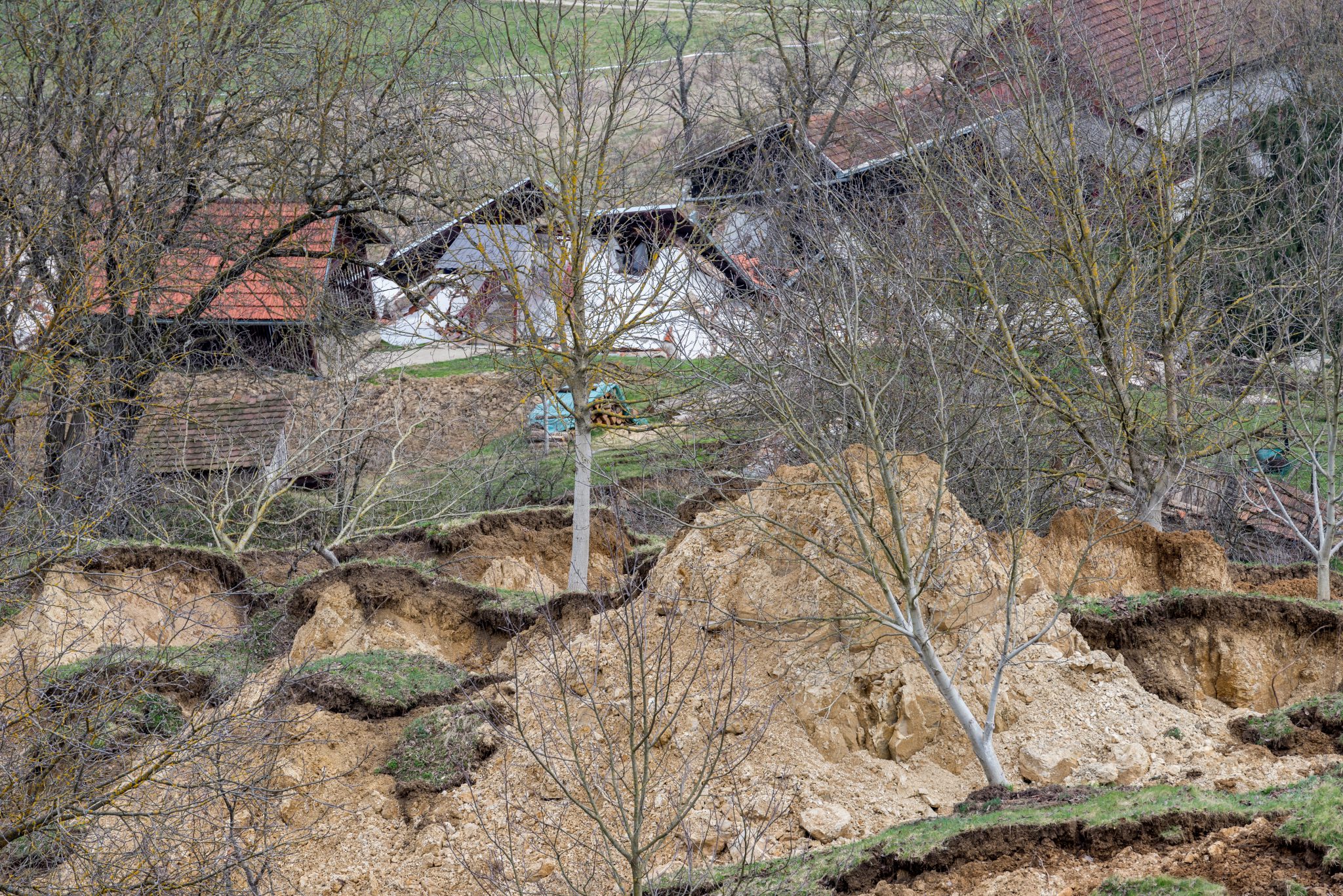
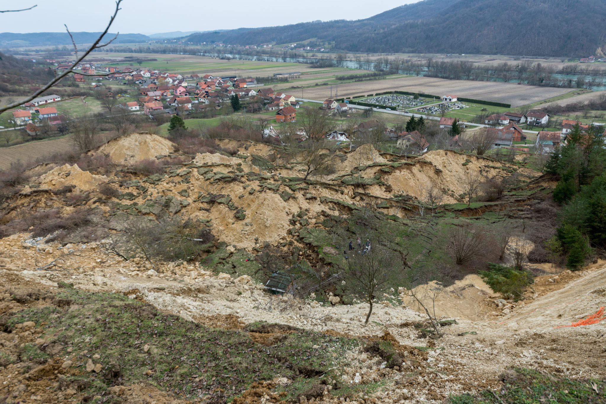
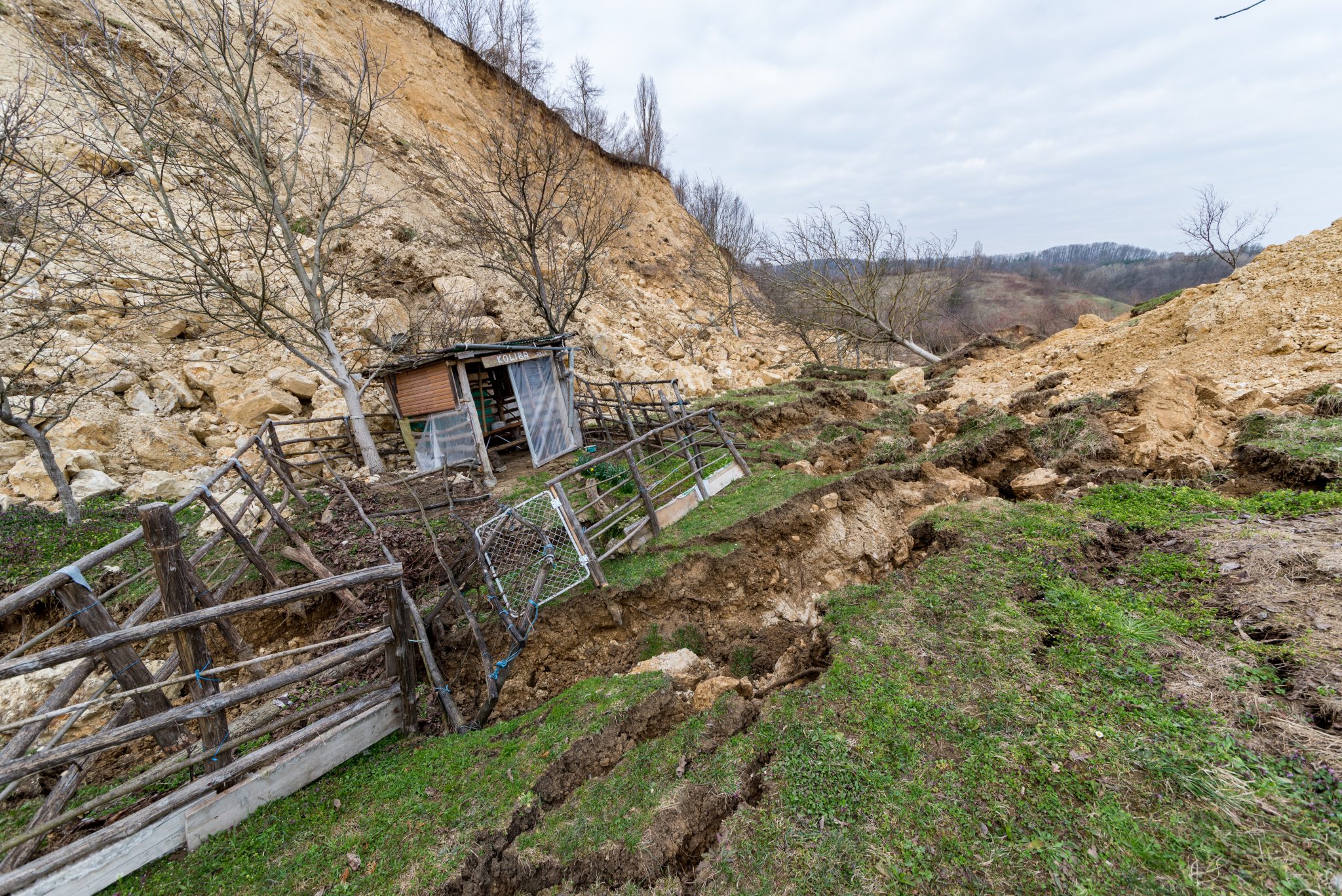
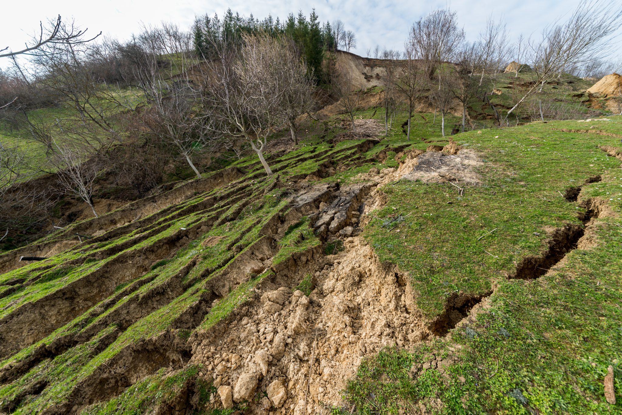
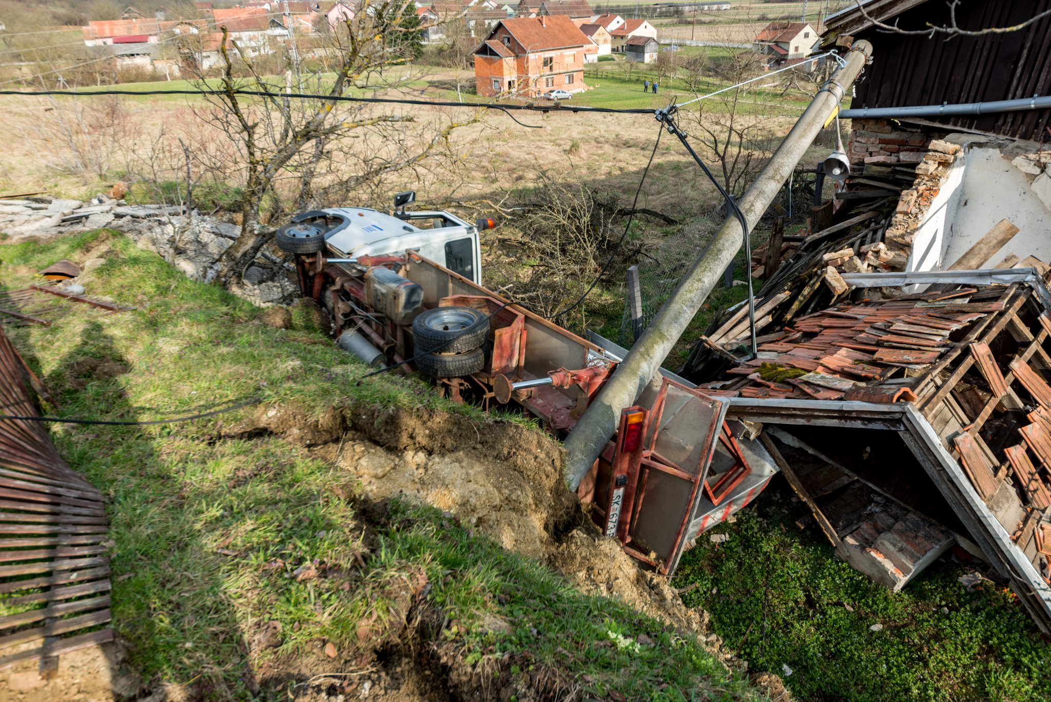
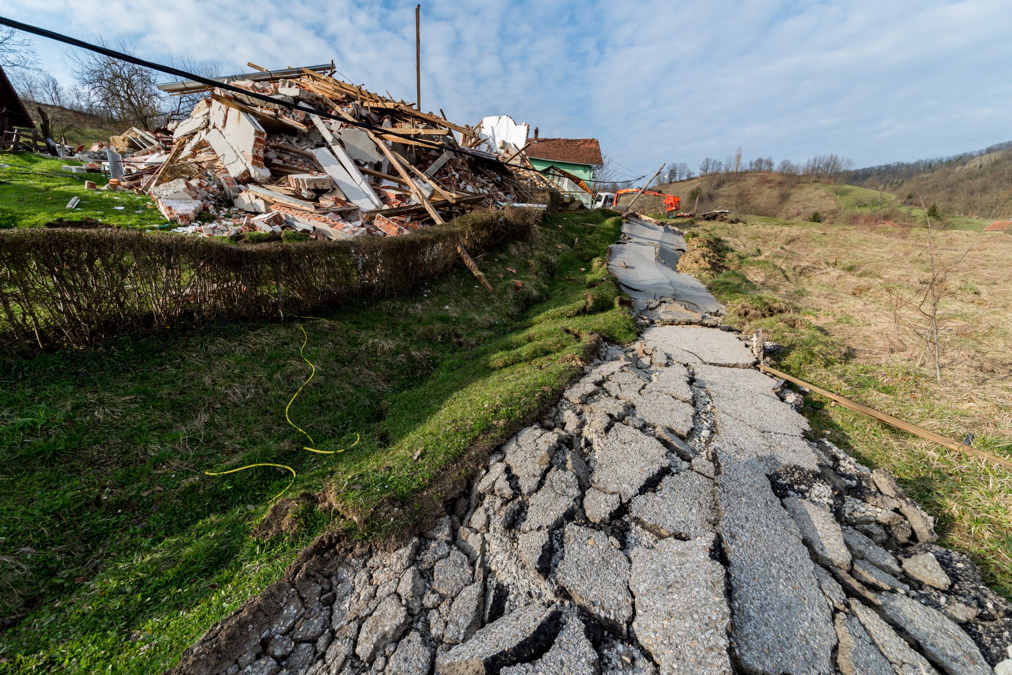
Development Agency Žepče (BA) will coordinate the pilot action in Žepče, where the most severely landslide affected area during the floods of 2014 will be reconstructed. The partner will demonstrate to other project partners, stakeholders and the wider public lessons learned in mitigating negative effects of landslide damage and the most efficient infrastructure methods to prevent future landslides.

Library


Take a look on safEarth’s videos showing terrain models of landslides in Slavonski Brod, Dvor and Hrvatska Kostajnica:

Damages caused by landslides in Hrvatska Kostajnica. The safEarth project will map out landslide areas in the Programme area and include them in Landslide susceptibility maps. The overall aim is to prevent this kind of damage and protect communities living in areas in risk of landslides.

safEarth findings are used to develop a web portal for reporting landslide areas. Contribute to safEarth’s database on landslide areas and report any landslide-related risks.

Photos, videos and materials published on this website are property of the safEarth project and are used with the permission of project partners.

Project partners can be contacted via project website: https://www.safearth.eu/kontakt/

Share this page:

This website uses cookies to ensure you get the best experience on our website. By continuing to browse on this website, you accept the use of cookies for the above purposes.​ Cookie Policy